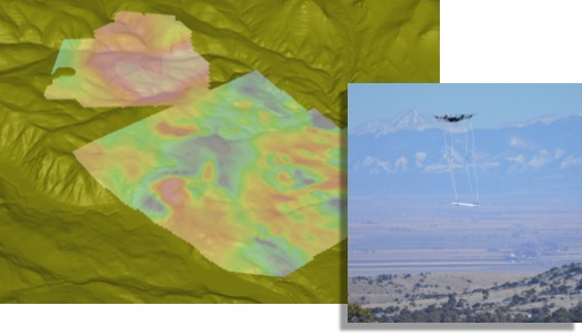
Geophysical and remote sensing technologies have become essential to the discovery and assessment of gold and silver, base metal, coal and uranium, and strategic mineral deposits. Airborne geophysical methods are employed to map large areas and increase the efficiency and success of the exploration program. Ground and borehole geophysical methods are deployed to map the subsurface geology and structure in much more detail with respect to the size of the prospect and commodity type. The Collier team collectively bring multiple decades of experience in the acquisition and interpretation of data with the following geophysical methods for resource exploration.
Geophysical Methods
Our sector leaders, Jim Pfeiffer and Phil Sirles, have extensive experience in mineral exploration geophysics throughout the US and around the world. Collier is leading the way in the application of drone enabled geophysics.