May 11, 2026
Fresh Groundwater Aquifers Under Utah’s Great Salt Lake?
Recent research has established that there could be vast freshwater resources
Prepared by Andrew Stone, Hydrogeologist (andrewstonewater(at)gmail.com)
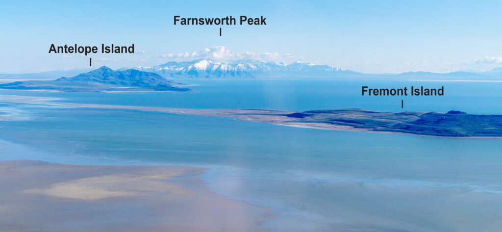
Antelope Island, left in this photograph.] Photo credit: EcoFlight
The 1,500 mile2 Great Salt Lake (GSL) in Utah is the largest endorheic lake (no external drainage) in North America. Geologically, GSL is on the eastern margin of the Basin and Range Province that extends west to California. The Great Basin comprises a series of north-south-trending mountain ranges separated by downfaulted deep sediment-filled basins. In endorheic lakes with no outflowing drainage and high evaporation, water becomes progressively salty.
The GSL today is a small remnant of the 20,000 miles2 Lake Bonneville that existed 15,000 years ago. Over the last 150 years the depth of the shallow GSL has varied by as much as 22 feet. In addition to direct rainfall, the input of water to GSL comes from inflow from rivers and seepage from lake margin groundwater.
Recent electromagnetic geophysics surveys of the Farmington Bay Area of the GSL by the University of Utah Department of Geology and Geophysics have provided evidence that there could be a considerable extent of freshwater aquifers beneath the GSL. (See report links below). One of the geophysical methods used was airborne electromagnetic (AEM). This measures the electrical resistivity of geology beneath the lake by transmitting electromagnetic fields from instruments flown over the lake by helicopter. Responses to the electromagnetic signals from lake sediments saturated with salt water indicate thin, highly conductive layers beneath the hypersaline lake water. Beneath these layers, the instruments identified layers with more resistant responses to the signals. The differing resistance indicates that the deeper sediments are saturated with fresher water than in layers closer to the lakebed. Freshwater-saturated sediments beneath the lake layer have also been confirmed by water salinity and chemistry measurements from test wells.
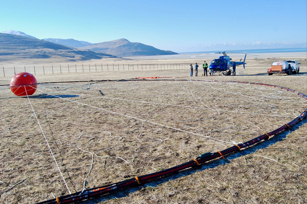
(Feb 2025) Photo: Brian Maffly, University of Utah
Geophysics equipment for airborne data-gathering Farmington Bay, UT (Feb 2025) Photo credit: Brian Maffly, University of Utah Geophysics technology can help delineate the geometry, extent, and internal structure of the geology beneath the lake. Previous geological studies have shown that in places there are depths of up to 9,000 feet of sediments below the lake overlying down-faulted basement rocks. If salty sediments over the whole lake are restricted to thin layers in near-surface zones, then the vast volume of sedimentary and volcanic rocks below the lake could potentially be freshwater-saturated.
What are the water management implications in the arid water-short western states of a possible vast GSL aquifer system with freshwater? If there are proven freshwater reserves, there will be economic and environmental issues that will require creative engineering solutions for any large scale water supply development. The State of Utah owns the GSL and presumably any development of water resources would be the state’s responsibility.
However, Farmington Bay is a relatively small area of the GSL and before the current research results can be extrapolated to the whole GSL Basin there needs to be extensive hydrogeological investigation to characterize the basin’s water resource potential. Geophysics is likely to be a key component of more comprehensive research to reveal the geometry and stratigraphy of the basin’s geology. Assessing the potential for groundwater development will also require characterization of recharge and flow systems and modeling of the basin’s hydrogeology and hydrochemistry.
There are recent research findings of extensive freshwater aquifers miles offshore below the seabed on New England’s continental shelf. There are confirmed freshwater aquifers occurring in the Mojave Desert that have been proposed as an augmentation source for Southern California water supply. Results from the Farmington Bay research of the GSL Basin’s freshwater potential would seem to justify investing in more hydrogeological research under the GSL.
Utah Geological Survey website (https://geology.utah.gov/) has many reports on the GSL. Reports on the subject of this article (GSL groundwater) are : Scientific Reports – Open Access, February 2026 (Principal reference) Journal of Hydrology April 2026